On our various trips across the country, we’ve tried to see most of the areas that Sally’s ancestors passed through on their overland trips between 1849 and 1853. The 1852 wagon train route from Henry County, Iowa, has been especially fun to follow because we had an excellent journal to read as we went along.[1]
We followed the McCullys through northern Missouri to St. Joseph in 1996 – although we drove from west to east, not the way they were traveling. We followed the route from St. Joseph to Nebraska City in 2000. We’ve covered various parts of the Oregon Trail through Nebraska and Wyoming a number of times. We linked them all together in October 1995 in one long adventure from Omaha, Nebraska, to South Pass, Wyoming.
Saturday 7 October 1995 – After our unsuccessful search for the grave of Joseph McCully (link above),we spent the night in York, Nebraska, near Interstate 80. This morning, we started from York on an almost 600-mile day to Casper, Wyoming, following Interstate 80 to Ogallala, Nebraska, then U. S. 26. We read John McKiernan's journal as we went along, and were pretty successful figuring out where the McCully train would have been on this day and the following one. Hard frost on the windshield in the morning, led into a fair day, high around 70F. We had some heavier clouds in Wyoming, but nothing beyond sprinkles (at Casper, after we arrived).
Interstate 80 follows closely the route of the Oregon Trail through Nebraska, and there are places near the freeway where deep wagon wheel ruts are still evident. We made the drive from York to Ogallala in less than three hours; the wagon train took ten days. We had a lot more traffic (obviously), but they weren’t alone; in the ten days, McKiernan made note of nine mule teams, thirteen horse teams, and 23 wagons pulled by oxen. He also saw two men pushing and pulling a wheelbarrow!
“Two men with wheelbarrow seemed to get along pretty well. One was pulling and the other held up the handles of the barrow. I have often heard of men going through in this way, but I never before believed it.”
Folks on the wagon trains saw something in this area that we didn’t:
“Today I saw about 500 buffalos, the first I have seen since we have got upon ‘the plains.’ Five of our boys went out and killed five buffalos, in consequence we did not drive more than 12 miles.”
In contrast, we saw something that they saw very few of: trees. The route that we drove was through mostly flat, wide open country – not prairie, anymore, but farmland. However, there were many trees, especially along the river edges. When the McCully wagon train passed through in 1852, they had to use dried manure – “buffalo chips” – for all their fires. McKiernan wrote:
“All the way up the South Platte we had no other kind of wood than buffalo chips, and they were as plenty as if the country had been used for a barnyard for all the oxen in Christiandom for 100 years.”
They had traveled 40 miles beyond Fort Kearny before they found a camping spot with a good supply of wood.
Considering what Humankind has done to most environments, us having trees and them not seems counter-intuitive. The key difference? Water control. Spring floods on the Great Plains scoured river banks, making it difficult for trees and shrubs to get started. With dams, reservoirs, canals, and other water control slowing down the natural runoff, vegetation had a better chance to get started, and stay growing from year to year. Strips of riparian vegetation developed where none had existed, previously.
At Ogalalla, we left the Interstate and continued west on U. S. 26 to… Well, I’ll let John McKiernan tell you:
“This morning we left 7 o’clock and struck across country, at 1 o’clock arrived at Ash Hollow. Before getting to it we had to come down one of the steepest hills I have ever seen a wagon go down.”
They would see more steep hills before they were through with their journey but, yes, it was steep. They locked the wagon wheels so they wouldn’t turn, and used ropes to slow and guide the descent of the 300 foot, 25 degree slope. The wheel ruts of thousands of wagons are still clearly visible.
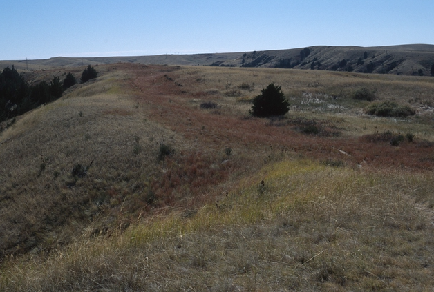
Wagon Ruts on the Hill and at the Top
McKiernan waxed eloquent about Ash Hollow:
“Ash Hollow is a most romantic place, but it would be impossible for me to describe it. Yet if the reader of this should feel curious enough to want to know what it is like, let him imagine a small plot of ground about 6 hundred yards wide and 12 hundred long surrounded by very high hills, almost perpendicular one side of it, or rather one of the hills composed of solid rock The other hill covered with ash trees, and through the cen- ter runs a swirling rivlet whose banks are covered with flowers of all kinds. ‘Birds of varied plumage bright’ fluttering in the branches of the trees. The rocky hill is to be studded with small cedar bushes, also to be filled with deep dark caverns, in which howl hungry wolves. Then let the reader imagine himself in the center of his imaginings without the least sign of an outlet, and he then will have a faint idea of what Ash Hollow is.”
Well, that’s a little over the top, but it is a nice place, particularly for folks not having seen a woodland of any kind since leaving Iowa. We’ve stopped there on a number of our cross-country drives. On this trip, we climbed the steep, paved trail to the top of the hill, where we could see the wagon ruts up close, and where we could see Ash Hollow as the wagon trains first saw it. Back in the parking lot, we took a quick look at the exhibits inside the “covered wagon” visitor’s kiosk. We thought we had the place to ourselves, until a five-foot long rattlesnake slipped out from behind one of the panels, about at the level of our chests. We didn’t wait around to learn any more about it.
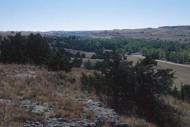
Looking down on Ash Hollow from the top of the hill
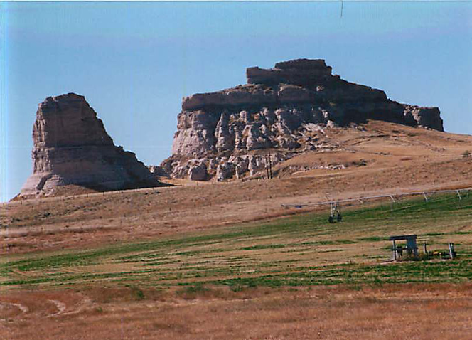
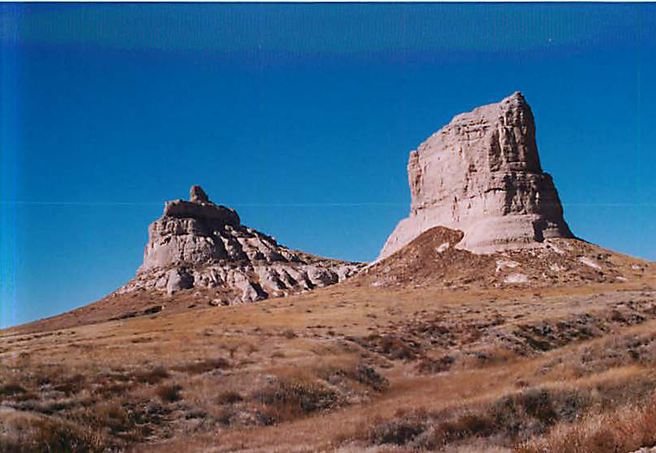
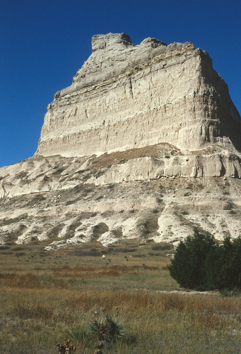
Continuing west on U. S. 26, the next points of interest are The Courthouse and The Jail. Our first view of them was similar to what those on the McCully wagon train would have seen on 19 May 1852 (except for the grain crop in the foreground, of course).
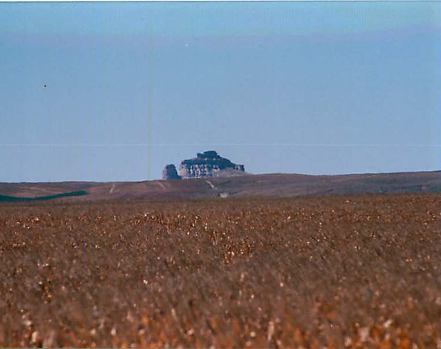
John McKiernan visited the rocks: “This morning we come in sight of The Court House, or Solitary Tower. We nooned at a small creek, and I then went to the Solitary Tower It is situated some 8 or ten miles south of the road, though it appears to be not more than one or two miles from It is a singular structure very much resembling a court house or some large public edifice. I would suppose it is 4 hundred feet high, perhaps six hundred, and I think covers 15 acres of ground. It is not very difficult of ascent, and the top of it is visited by a great many travelers. I was upon its summit and placed my mark along with many others. The rock is quite isolated. At its base there runs a gurgling brook singing its little song, as it were, to enliven the loneliness which creeps upon the person who stands upon its top.”
He was wrong about the distance to the rocks from the trail. It is about two miles. We didn’t visit them on this particular trip, but we took these photos on another cross-country drive. Again, except for the irrigated cropland at their base, The Courthouse and The Jail are still much the same as in 1852.
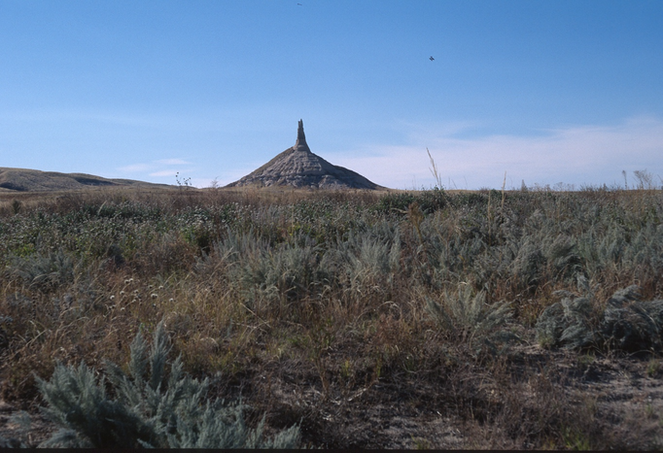
Not much farther up the road, one of the most famous landmarks on the Trail came in view – a great piece of Nature’s architecture – Chimney Rock. McKiernan commented on it, but the train traveled on by without exploration. We did the same.
A half-hour beyond Chimney Rock, we were at another famous Trail landmark – Scott’s Bluff. (It took the wagon train two days to get there.) McKiernan’s journal has a story about how the Bluff got its name:
“A few years (ago) a company of emigrants or traders were passing through this part of the country. They were very scarce of provisions & one of the party became sick. They had no means of taking him along with them, and it was impossible to stay with him. So they could do no better than leave the poor fellow ‘alone to die.’ When they had left him, he rallied all his remaining energies and succeeded in crawling along the Bluffs for a considerable distance where some Indians found him, and took compassion on him, and carried him to their wigwams and cured him & when he was well they sent him on his journey rejoicing.”
Pretty good story, right? But M. J. Mattes, in his 1969 book “The Great Platte River Road,” took ten pages to recount various versions of “the tragedy of Scott’s Bluffs.” McKiernan’s is the only one in which the man survives! It now seems clear that the man in question was one Hiram Scott, of the Rocky Mountain Fur Company, who – for one reason or another – died in the vicinity of Scott’s Bluff.
After spending a little time at the Bluff, we pushed on another 150 miles to Casper, Wyoming. It took us two and a half hours on U. S. 26 and Interstate I-25. It took the wagon train ten days.
Sunday 8 October 1995 - A little light snow overnight stuck on cars, but not on the pavement. After that, the day was bright and sunny. We had a long day to Salt Lake City, first taking Wyoming Highway 220 west past the Pathfinder National Wildlife Refuge (didn’t stop), to the next famous Oregon Trail landmark – Independence Rock. Given the name by William Sublette when his party camped beside it on 4 July 1830, it would be remarkable even without its colorful overland trail history. A formation of black granite 1900 feet long and nearly 150 feet high, there is nothing comparable – or even similar – in the vicinity.
Curiously, John McKiernan (usually so eloquent and profuse in his descriptions) barely mentioned the Rock, only noting that they camped at its base. We know from other sources that a number of the members of the McCully wagon train climbed the rock, and left their names - along with those of thousands of others - in paint, axle grease, or whatever else they had. Many are still readable, today.

Just a couple miles beyond Independence Rock, we could see the cleft of Devil’s Gate, through which the Sweetwater River passes. At the river, the gorge is only about 30 feet wide, too narrow for wagons to pass through. McKiernan remarked on its presence as the wagon train passed around it, but apparently they didn’t stop. Neither did we. (We did spend awhile there on a later trip.)
Beyond Devil’s Gate, we met U. S. 287 and followed it west to Lander, Wyoming. We had been gaining elevation all the way from Casper, at 5100 feet, to about 7000 feet at the height of land before Lander. There are no steep grades, and it’s hard to believe you have really gained that much. John McKiernan wrote:
“The pass is a slight undulating plain between mountains several miles apart. The ascent over the pass is so gradual as to be almost imperceptible.”
Actually, we had another 60 miles to go before we saw the actual “summit” of South Pass. From the height of land on U. S. 287, the wagon trains traveled west another 20 miles or so, with only a slight elevation gain, to the point at which waters begin to flow westward, rather than to the Missouri and Mississippi. We descended almost 2000 feet to Lander; got Big Macs or Whoppers (don’t remember which); then on Wyoming Highway 28, climbed 2000 feet back up to South Pass. I suspect the Oregon Trail travelers would have been very grateful for their cut-off, had they known about the alternative.
Not far below the summit area, the McCully wagon train turned west, and made its slow progress into Idaho. We continued south, eventually intercepting Interstate 80, with its never-ending lines of long-haul trucks, and almost 200 miles of busy, high speed, traffic to Salt Lake City for the night.
---------
[1] The journal of John S. McKiernan, reproduced in: S. R. and S. H. Wilbur. 2000. The McCully Train, Iowa to Oregon 1852. Gresham, Oregon: Symbios.
To the Writing It Down Homepage