After our weekend trips in 1956, I was now really hooked on mountains. Charlie and I began to plan a big adventure, a long trip into the real High Sierra (even higher and wilder than the Yosemite backcountry). I had hiked the Bubbs Creek Trail out of Kings Canyon two years before, and knew that it would take us two days going that way to get where we wanted to go. But after poring over topographic maps, we thought we saw a way to go cross country that would save a day or so over the time it would take us if we followed the marked trails. My Dad and my brother Roger decided they wanted to come along with us (probably because Mom and Dad were not too keen on two teenagers going off into the mountains by themselves). Charlie and I had some worries about having them along, because this was going to be a cross country trip, and the two of us were mountain acclimated and really in backpacking shape. In addition to our mountain trips, we had spent a number of days walking around the Oakland hills with our backpacks full of bricks, getting used to the weight of long trip packs. (We were up on Joaquin Miller Boulevard early one morning while it was still dark, and a policeman stopped us to find out what we were doing. I don’t remember if he found out what was in our packs, but we got worried that he might think our loads of bricks were the result of some “moonlight requisitioning” at some of the new home building sites, rather than mountain training. He apparently was satisfied with our rather odd explanation.) Roger still suffered occasionally from asthma, and Dad was “fit” but not conditioned. Nevertheless, it was decided that it would be a foursome on the trip.
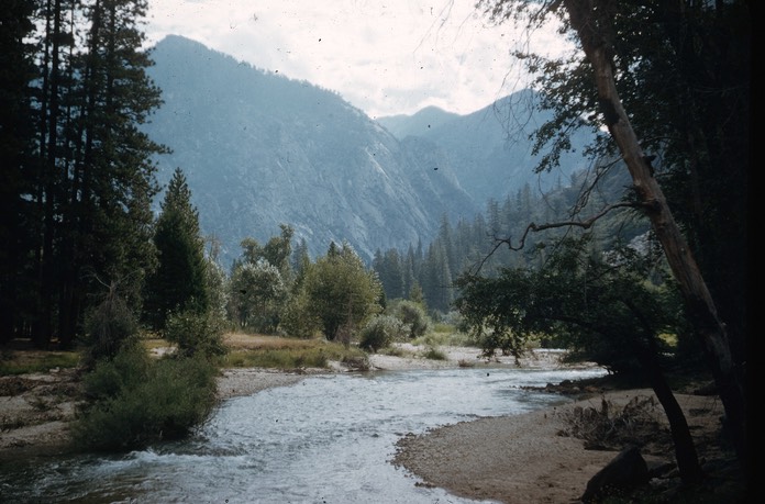
Zumwalt Meadows, the start of the trip
The first day we drove to Kings Canyon, and hiked up the Kings River to Mist Falls, where we camped for the night. Our plan was to climb directly up the east wall of Kings Canyon from Mist Falls, to meet the Gardiner Basin Trail at about 10,000 foot elevation. On the topographic map, the distance was only about an inch [a couple miles], and there were no big cliffs to deter us. Even gaining 5,000 feet elevation and traveling without a trail, we could do that in a day with no problem, couldn’t we? [After all, hadn’t I done the same elevation up and down in twenty miles in one long day in 1955?] How wrong we were. First, it took us quite awhile to find a crossing over the South Fork of the Kings River just to start the climb. The first uphill after that wasn’t too bad, but before long we got into brush so dense that we soon were barely moving up the steep slopes. By the end of the day, we were only two-thirds of the way up the canyon wall (probably less than two miles in actual distance from where we’d started); we’d kicked up a lot of yellow jackets [seems like one of us got stung - Charlie or Roger?]; and Charlie and I were separated from Dad and Roger by a relatively short distance, but by acres of discouraging brush. We ended up bivouacking for the night right where we were. Roger and Dad found a relatively flat place to bed down; Charlie and I ended up on a slab of granite protruding above the brush, but so steep that all night we had to keep hitching our sleeping bags back to the top of it. We ate cold food that night.
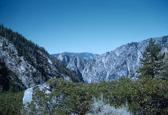
Looking Back at where we came from
And Ahead to where we were going
In the morning, we regrouped and headed uphill, passing a couple of very cold small rattlesnakes on our “trail.” It turned out that we were through the worst of the brush when we stopped for the night, and the trip on over the lip of the canyon wall and on to the Gardiner Basin Trail was completed by noon or so. Beyond the junction (where we saw a lone fisherman, the only person we observed until we reached the John Muir Trail two days later), the trip far exceeded any of our expectations. We were above the forest, with only gnarled picturesque white-bark pines on vast expanses of white granite, with every little hollow containing a glacial lake. We ambled from one lake level to the next to the end of the trail at the utilitarianly-named Lake 11,394, where we camped for the next two nights.
There wasn’t much “camp” to “make,” since there wasn’t any firewood to gather and nowhere to lay our sleeping bags but on the exfoliated granite sands. While Dad and Roger settled in and got acclimated, Charlie and I ran up ([literally) the slopes of Mt. Gardiner. Most of the way to the summit ridge was on hard-packed snow. That part was not very difficult, but the airiness of the ridge got to me, and Charlie went over the last knife-edge by himself, while I waited. We glissaded quickly back down the slopes to the lake, arriving well before nightfall.
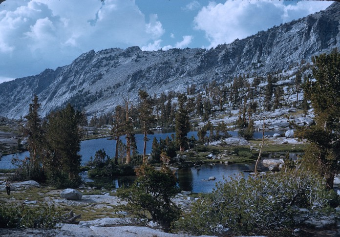
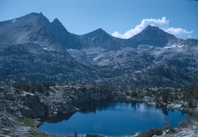
Mt. Clarence King and some of the Gardiner lakes from Mt. Gardiner
The next day, Roger and Dad loafed and fished, while Charlie and I climbed Mt. Cotter (which forms the east wall of Gardiner Basin, across from Mt. Gardiner). It wasn’t a hard climb - mostly a slip-and-slide over lower talus boulders and then higher scree slopes - but the view was fantastic of Gardiner Basin below us to the southwest, Sixty Lakes Basin below us to the east, and miles and miles and miles of High Sierra stretching out in every direction. The next point north of Mt. Cotter is Mt. Clarence King, in my opinion one of the nicest shaped mountains in the Sierra. On our maps, it had looked like we might be able to drop down the north side of Cotter and traverse across to King, but it turned out to be extremely precipitous and was well beyond my talents (and probably beyond Charlie’s, too, at that time), so we went back down to Lake 11,394 the way we had come up.
In the morning, we broke camp and made our way cross-country over the Cotter divide to Sixty Lakes Basin. There are at least sixty lakes and ponds in this beautiful little glacial basin. We camped there and fished (some of the party caught some lovely little golden trout), and Charlie and I climbed up on the slopes of Fin Dome to get some views north into John Muir Trail country. The next day, we worked our way over the next divide to the Muir Trail at Rae Lakes.
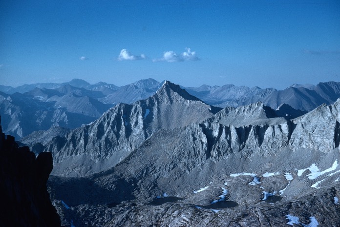
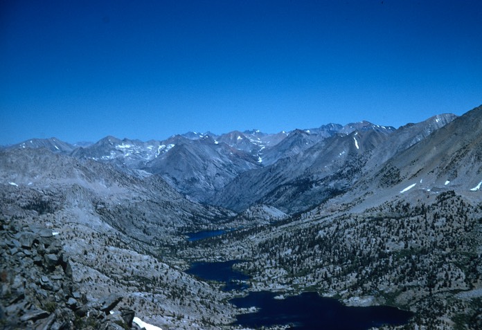
Mt. Cotter and Mt. Clarence King from one of the Sixty Lakes
The Muir Trail was not yet crowded in the 1950s, but we met and camped near several parties at Rae Lakes, the first people we had seen since reaching the lower end of Gardiner Basin after our climb up the South Fork Canyon walls. (The Sierra Club was already decrying the damage from too much camping use at Rae Lakes, and especially on the other side of Glen Pass at Bullfrog Lake. Who could have known how busy it would get, and how bad the damage would get in the next twenty years!] On our way up the long climb to Glen Pass, Charlie and I took a side trip to climb the Painted Lady (really just a big pile of scree, but fun), meeting Roger and Dad again near the summit of the pass.
North over the Rae Lakes from the Painted Lady
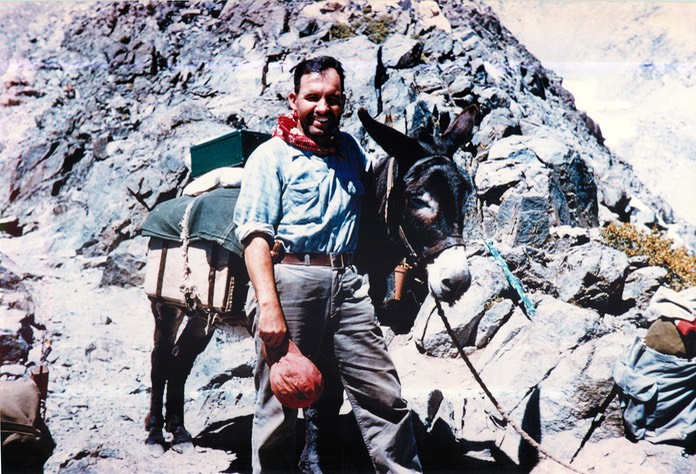
Dad with a passing friend at Glen Pass
We continued on down the south side, passing several parties of backpackers and burro parties, and camped at Junction Meadow, only a few miles from where Norm Waage and I had turned around on our Bubbs Creek Trail hike in 1955. On the final day, we descended the 15 miles and 6,000 feet to the floor of Kings Canyon, and then drove back to Oakland.
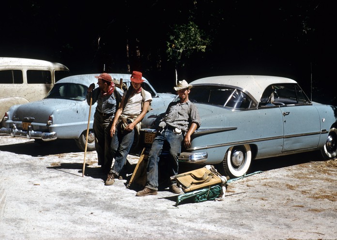
Part of the triumphant band, back at the start
Despite the surprises we had getting up to Gardiner Basin, Charlie and I were pretty proud of our route-finding successes. The High Sierra was all it was cracked up to be.
* * *
[Retrospective, 2020: Back in the 1950s, the National Park Service was already closing favorite camp sites along the John Muir Trail because of damage to the meadows and forests by too many users. Granted that some of the most damaging use – from large mule and horse parties – was curtailed, overall use has continued to grow over the ensuing 75 years. On our trip in 1956, not far off the John Muir Trail, we backpacked and camped for several days, and only saw one person. We climbed several mountains by the only routes that had so far been pioneered up them. Today, that location is actually remoter than it was in the 1950s, because the only real trail to it was abandoned years ago. Even so, a 2009 climbing guidebook includes detailed directions on how to approach the region, and has dozens of new climbing routes described. I haven’t been back, but I suspect I wouldn’t go one day without sharing the area with quite a few others. I’m sure it’s still “wild” because it still takes two days of hiking to get there, but it suggests to me that we need additional travel limitations in some of our wildernesses, to preserve the character for which they were established.]
To the Writing It Down Homepage
Leave a Comment: symbios@condortales.com